|
|
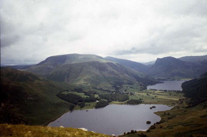
Lake District Mountain and Fell Walks 13See also: The Twelve Best Walks In The Lakes MellbreakMellbreak stands massively aloof and magnificently alone beside Crummock Water. Climb its two peaks, and enjoy the stunning views. From the Kirkstile Inn junction, follow the road, west, to cross Church Bridge, with ahead a fine view of the craggy northern end of Mellbreak. The way soon becomes a stony walled track, passing Kirkhead and then Kirkgate farm, both on your right. Carry on until just before a gate. Look over the wall on the right to see what is named on the map as an ancient earthwork. Go through the gate and take the distinct valley path, with Mosedale Beck away down to your right. Head on along the clearly defined track, for nearly a mile to reach a Y-junction. Take the upper left branch, and a short way along and just beyond a gill, look for a path ascending straight up the west slope of the fell to reach a cairn on the extensive grassy depression between the two tops. Turn left and walk the grassy, and often damp way, to the northern top, 509 m / 1670 ft, from where there is a tremendous view. Look down, with care, to see if you can spot the more distinct outline of the ancient earthwork.
Return across the depression and go on, without losing height, to climb towards the southern top, the true summit, 512m/1680ft. Pause to enjoy the astonishingly lovely view. Then continue on the clear path over the heathery top to begin your descent, with boundary posts to your left. The clear way descends to a fence. Turn right and go down beside it to reach a stile. Beyond, follow a good path that leads downhill towards Scale Beck to join a rough track, where you turn left and head for Crummock Water. Ignore the footbridge across the beck and go through a gate, remaining on the same side (north) of the beck to descend to the lake. Wind on round, left, on the path to pass High Ling Crag and then the charming peninsula of Low Ling Crag. A short way beyond, at a Y-junction of paths, leave the lakeshore by the left branch. Head up the fellside and then follow the clear way, roughly parallel with the shore path, traversing the lower east side of the fell. Wind round a rocky area and then skirt Green Wood, with Highpark to the right. Continue on along the access track to cross Park Bridge over Park Beck. At the Y-junction turn left to return to the Kirkstile Inn and some well earned refreshment. Information Start/finish: Kirkstile Inn Distance: 11.4km/7 miles Time: 4 miles Height gain: 400m/1300ft Terrain: Generally moderate, challenging in parts. Can be wet underfoot in parts Refreshments: Kirkstile Inn Toilets: None on route. Buttermere nearest Public transport: Honister Rambler. Stagecoach in Cumbria 77/77A. For details phone: Traveline 0870 608 2608 Park: If for some reason the Inn’s car park is full, or unavailable, use Maggie’s Bridge car park, grid ref 136211. From the latter, return to main road and take two right turns. Or use Scalehill Bridge car park, grid ref 149214. To reach the Inn, return to the main road, turn left and walk on to take the second left. Maps OS Explorer OL 4 Copyright Mary Welsh, © 2008. All rights
reserved. No reproduction without permission. |
|