|
|
Lake District Mountain and Fell Walks 3
5 Skiddaw and Dash Falls
Skiddaw and Dash Falls Factfile After parking stride back down the lane for a metre to where the road veers sharp right. Here climb the signposted stile on the left. Beyond, walk right, over the pasture to go through a stile. Ford dancing Mill Beck and walk on to take the next stile. Go on ahead through a gate and press on, with the hedge to your left, to pass through another.
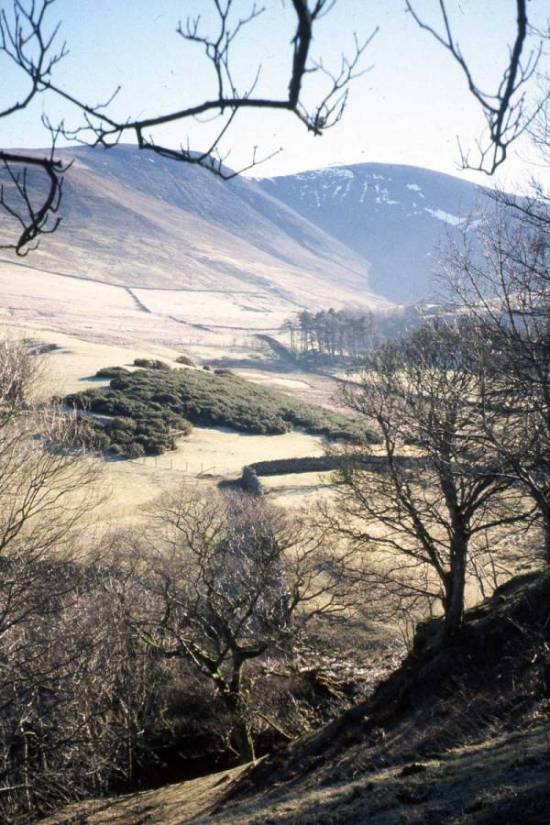
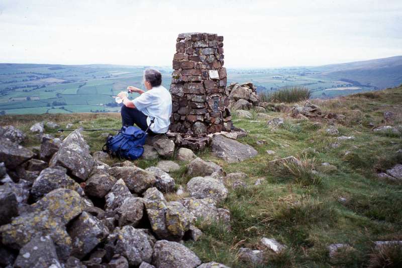
View of Skiddaw (Copyright Mary Welsh, © 2007) Once over the unusual stile, turn right into a wide track, to pass Barkbeth farm and its outbuildings. Straddle the stile ahead and stroll on, with the wall to your right, to pass through a gate. Once through, drift steadily left, descending all the time to take a small gate in the wall. Go on downhill, bearing left towards a row of hawthorn. Pass through to join a path and walk left again, steadily climbing, now with the straggly hedge to your left. Climb the next two ladderstiles and then bear sharp right to straddle another, which gives access to the track that leads into Southerndale. At this point strike right, up a faint path onto the rough grassy fell slope. The path along The Edge soon becomes apparent and it stretches ahead of you, up and up, towards Ullock Pike. Look for the ‘Watches’ as you go, a collection of upstanding rocks, assembled like statesmen in conference. The switchback way climbs steadily for the next 830 m, with several small scrambles to make it fun. It appears to lead straight to the summit, but the real top lies at 680 m (2,230 feet), unexpectedly, just beyond the high point that has been in your vision from the Watches. Pause here to enjoy, below, the spectacular view of all of Bassenthwaite Lake and much of Derwent Water. Look north across the low land of West Cumbria to the Solway and the Galloway Hills. Stroll on along the wide top of Longside Edge. The delightful cairned way descends too soon to a junction of tracks. Here, to your right, stands the domed, undistinguished summit of Carl Side. Ignore that way and turn left to begin your ascent of the well trodden slatey path that ascends Skiddaw’s vast scree slope, from where you can look down the whole length of lonely Southerndale. Go on up and up until you reach the wide flat plateau of Skiddaw’s top. Bear left to pass several cairns to reach the rough shelter on the summit, 931m (3,053 feet). If there is no mist you will want to linger to take in the magical view. Then amble on along the path as it begins its steady descent. When a boundary fence comes into view on your right, follow the path towards it. Walk on beside it and do the same where it bears right. Where it bears right again, you might wish to make a short diversion, left, along a wide track to the cairn on Bakestall. Here you are level with ascending meadow pipits and almost as high as the soaring skylarks. Return to the fence and follow it down and then descend more steeply along Birkett Edge, keeping well clear of Dead Crags, to arrive at the bridleway between Skiddaw House and Peter House farm. Turn left along the wide track below Dead Crags. As you go look right for your first glimpse of Dash Falls. Remain on the track until your reach a narrow path, on the right. Here you might wish to take another diversion leads downhill to the side of beck. If it is not in spate step across, avoiding the slippery green boulders and pause in a hollow by the plunge pool. From here the view upwards is most impressive. Return to the track and stride on. Cross a tractor bridge over Dead Beck and carry on to join a wider metalled track. Follow this, left, steadily downhill and, as you go, look left for a splendid view of Ullock Pike. Continue on the track to the road, and the layby, at Peter House farm. Copyright Mary Welsh, © 2007. All rights reserved. No reproduction without permission. 6 Binsey FellBinsey Fell Factfile Volcanic Binsey is the last fell you see when heading north along the old road (A591) in the direction of Carlisle. It is a glorious rounded, grassy hill, with a stunning panorama. It lies just outside the Skiddaw slates, and has a trig point set atop an ancient tumulus. The route first takes you over the quiet, gentle pastures between
Overwater and Ruthwaite, where John Peel lived for much of his life. It
continues to the hamlet of High Ireby, its cottages and farms snuggling
beside pleasing, but private, woodlands. The way then goes on over slopes,
along grassy trods, with spectacular views across the Solway into
Scotland. The next section of the route is the ascent of the Binsey Fell,
450m/14466 itself; nothing too difficult, but you might need some pauses
to enjoy the ever increasing views - and to catch your breath. And then
the magical moment comes as you reach the summit. Most of the north-west
hills can be seen, with the added bonus of more of the Solway as it surges
out into the Irish Sea. The summit of Binsey Fell (Copyright Mary Welsh, © 2007) At its end, cross the road and walk on a couple of steps down the lane, opposite, to take, on the right, a hidden stile in the hedge. Head over the pasture to a gate, halfway along a fence. Bear left and walk down to a gate just before Rosthwaite Beck. Cross this by a tractor bridge. Bear right alongside the beck to reach the reinforced path, which comes up from a plank bridge, and leads you on to the corner of two hedges and a stile, from where you continue. Cross the narrow pasture to take the next stile. Beyond, continue straight ahead over a large field to an easy-to-miss stone step stile. Then walk on to come parallel with a wall on the left. Bear slightly left to a stile in the far left corner. Next walk left and then right to come to a narrow fenced way and another stile. Continue on into the delightful hamlet of Ruthwaite, where you turn left. At the crossroads, go ahead along a tree-lined lane in the direction of High Ireby. Go on, steadily climbing, to take the first left turn and, at its end, turn left again to take a wide reinforced track. Follow this, enjoying the magnificent views as you go. Go on ahead, where the track becomes less firm underfoot and follow it as it dips to ford the narrow, shallow Humble Jumble Gill. Go on along the track, through gorse,to climb a ladderstile onto the open fell. Turn left to stroll beside the wall on your left to the next stile. Go on, keeping parallel with the wall, now on your right, and follow it where it turns away right. Stroll on to reach a signpost. Here carry on, left, along a wide green sward. Cross a tiny stream and then pass to the left of a small plantation. Go through the next gate and on along the airy way to go over the brow. Just beyond, look for a tractor-marked way going off left in the direction of Binsey Fell. If you do not spot the start of the indistinct track, continue over the easy-to-walk pasture and you will soon see the path stretching ahead. Cross an old turf bank and follow the tractor marked track as it drifts slightly left to come to a small gate in the fell wall. From now on the way is clearer as it passes through cushions of heather and begins to climb. Pause here to look back down on the faint outlines of the Roman fort of Caermote. Go on up to pass to the left of the outcrops of West Crag and then, once over the last brow, you can see the path continuing along the little ridge to the summit. Go on to descend a wide grassy trod (a permitted path) that takes you down and down to a ladderstile over the wall and onto a narrow road. Stride left and walk the few metres to join the road to Ruthwaite. Turn right and continue, with care, to the foot of the steep hill on the B-road. Then walk left along the narrow road, signposted Overwater. Continue along this pleasing way for 2 km. Eventually you pass the tarn, Over Water, with no access for the general public, the fourth largest in the Lake District. At the end of the tarn and the lane, turn right to the car park. Copyright Mary Welsh, © 2007. All rights reserved. No reproduction without permission. |
|