|
|
Lake District Mountain and Fell Walks 5
9 Seven Northern FellsSeven Northern Fells Factfile Leave the top by a good path, which descends south east to cross dry Broad Moss. Soon the path begins to climb steadily towards the main track through Charlton Gill, an old bridleway. Join the latter and head up to the left of Little Scafell. At a cross of tracks, go left for an easy 1 km diversion to the top of Brae Fell, 586 m (1,900 feet), adorned with a fine cairn and a small shelter. Return to the cross of tracks and go up the steepish narrow path to Little Sca Fell, 624 m (1,960 feet), it too with a small shelter just right for your first break. Look south from here to see the fell’s twin, Great Sca Fell, 651 m (2,131 feet), and follow the clear grassy track down a little and then up, more, to its large flat summit and cairn. From here you can see, south east, the Knott, 710 m (2,329 feet), the highest top on this walk.
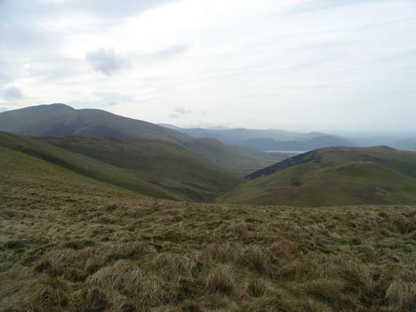
Looking down on Bassenthwaite (Copyright Mary Welsh, © 2007) Stand on your approach path, facing the cairn, and turn acute right. Walk a narrow path, which soon joins another splendid wide grassy track, where you turn left in the direction of Little Calva. Do not enjoy this for too long, because at the first suspicion of descent, leave the track, right (west). Walk ahead over tussocky grass, descending gently to join a narrow path and walk right and follow this as it bears left, round a large peat hag. Then go on over pathless heather moorland towards the top of Burn Tod, 600 m (1,972 feet). There is a boggy stretch to cross but weave round the little pools heading for the grassy slopes of the summit. There is still no path and the top seems to be marked by a solitary piece of quartz. Descend right, north west, a short way down the pathless slope, until you reach the edge of a steep drop down to Frozen Fell Gill. Here join a splendid narrow path that runs left, north west, along the rim of the slope. It soon curves round right and descends, the first of the large zig-zags that take you pleasantly down to Trusmadoor, a glorious hollow. This is a good place to sit in the sun and out of the wind to enjoy your next break. It is a remote high passageway through the hills. Here Frozenfell Gill becomes Burn Tod Gill and the stream chatters through the hollow. After crossing the beck, step out of the hollow and follow the path, north, passing below Great Cockup on the left and Meal Fell on the right. Soon you reach a small area of scree and rushes growing across the track. Here the way divides and you should take the right branch, a narrow path. This takes you along the lower slopes of Meal Fell. Where the path divides again, keep to the lower path to wind round a hillock. Step across a narrow tributary of the River Ellen and carry on below Lowthwaite Fell and then Longlands Fell to arrive, after 3 km from Trusmadoor, at the gate to the road below Longlands farm. Copyright Mary Welsh, © 2007. All rights reserved. No reproduction without permission. 10 High Crag, High Stile, Red Pike, Scale ForceButtermere Fells Factfile From the parking area, wind, right, round the inn and follow the good track towards the foot of Sourmilk Gill. Cross the footbridge over the Dubs and turn left to stroll the lakeside path through Burtness Wood. Leave the trees by a gate to follow the delightful way along the shore of Buttermere. To your right rises the great wall of fells along which you will eventually walk. Cross the footbridge over Comb Beck, which issues dramatically from Burtness Comb. Carry on until you reach a path that goes off on the right and climbs gently. Follow this to reach the corner of a fenced mixed wood. Here begin your ascent of Scarth Gap Pass, where there is no pony to carry your rucksack on this packhorse route once used to carry goods from Buttermere to Wasdale. Continue on to pass through a gate. Beyond, continue up the reinforced path to pass between Low Wax Knott and High Wax Knott, to come to a gap in a wall ahead. Go through and turn right to walk to the end of the wall. Here begin your way uphill on an indistinct path, which half-way up the slope becomes clearer and leads you to the brow. Then follow the continuing path to the top of the ridge. Soon, after descending a few steps, join a good pitched path that comes in on your left, from Seat. Turn right and follow the pitched way as it begins to climb Gamlin End. Away to your left is the occasional old iron fence post; these remain a guide for much of the way along the ensuing ridge. Pause as you climb to enjoy the fine views of the waters of Ennerdal, to the left of High Crag, and of Crummock Water to its right. Look back to see Green Gable, Pike of Stickle, Harrison Stickle and then much of the Helvellyn range. Immediately to your left, across Ennerdale, you can see Pillar and the other Red Pike.
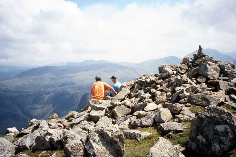
Summit of High Crag, (Copyright Mary Welsh, © 2007) Go on along the ridge, descending gently on a narrow path that weaves in and around boulders and outcrops in the direction of High Stile, the next huge rocky lump ahead. Head on along the ridge, narrow here but not too exposed, with Burtness Comb below and Eagle Crag also to the right. Go on along the stony path as it starts ascending and continue to the highest point on the whole ridge, High Stile, 807m/2644ft. Pause once more to look ahead along Chapel Crags and, with care, down to Bleaberry Tarn, jewel-like in its hollow. Then after some scrambling down the rocky path begin the pleasing trek along the cairned ridge towards Red Pike. After an easy ascent you attain the large summit, 755 m (2,479 feet), the cairn standing at the head of the rough path up from Bleaberry Tarn.
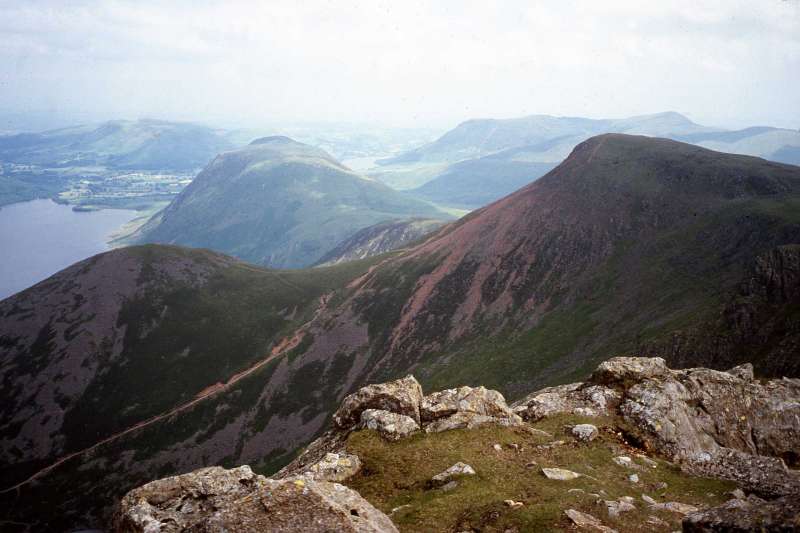
Red Pike from High Stile (Copyright Mary Welsh, © 2007) As you descend choose one of the indistinct gully-like paths that go down the long, steepish, shingly, slithery slope to come to Lingcomb Edge, overlooking the bleak Ling Comb. Walk on and then bear off, a little left, on a wide, rough track, heading in the direction of Mellbreak, the fine fell that stands tall on the west side of Crummock Water. Eventually, long after you have lost sight of Red Pike behind you, you reach the side of Scale Beck. Bear right to walk along a narrow path of red soil and red rock, with the delectable Scale Beck dancing down its gill. Soon its banks become clad with rowans and you have a fine view of Crummock Water. Occasionally a little scrambling is required and you need to descend with care. After 0.3 km you pass Scale Force, a spectacular waterfall, which descends 30 m in one great continuous fall into a very deep cleft, densely clad in ferns, rowans and holly. The path goes on down through woodland to descend a pitched zig-zag. It then goes on down, still further, to come to a large gap in a wall on the right. Go through and stroll the cairned path, with Crummock Water below you to the left. Look ahead from one cairn to the next as you go, to pick out the narrow and sometimes boggy way. Watch out for where the cairns encourage you to make a sharp left turn towards the lake. Then they lead to the right along a lower and slightly easier way. From here you can just see, above its forested slopes, the summit of Red Pike spiking upwards. Walk on along the rapidly improving path that brings you beside Buttermere Dubs. Cross Scale Bridge and walk the track beyond to return to Buttermere village. Copyright Mary Welsh, © 2007. All rights reserved. No reproduction without permission.
|
|