|
|
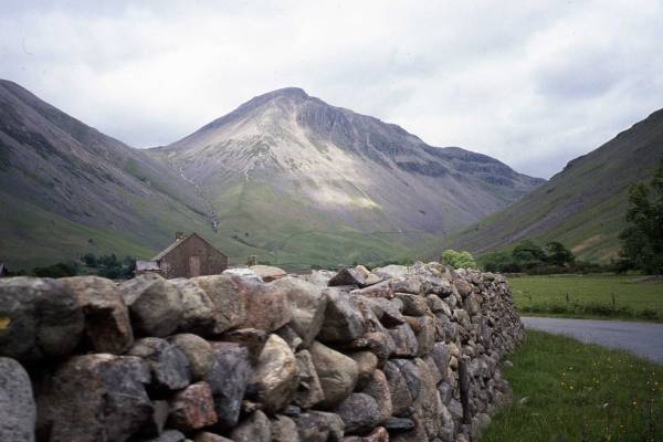
Lake District Mountain and Fell Walks 11 Great Gable from Wasdale HeadGreat Gable Factfile The summit of Great Gable is instantly recognisable from wherever you view the Lakeland mountain profile. Its rounded bun-like top makes it a familiar, homely giant. But don’t be deceived by the mountain’s friendly face; mist can quickly descend and make it dangerous. Save your ascent for one of those glorious days when you have Lakeland, Lancashire, Yorkshire, Scotland and South Cumbria seemingly close at your feet. As you go, notice the sturdy walls in the
valley bottom. These were built during the 18th and 19th centuries to
enclose moorland, previously common land, to provide pasture and shelter
for sheep. The stone used was taken either from the open moor or the bed
of the beck. Any excess stone was gathered into huge mounds known as
clearance cairns and these can still be seen.
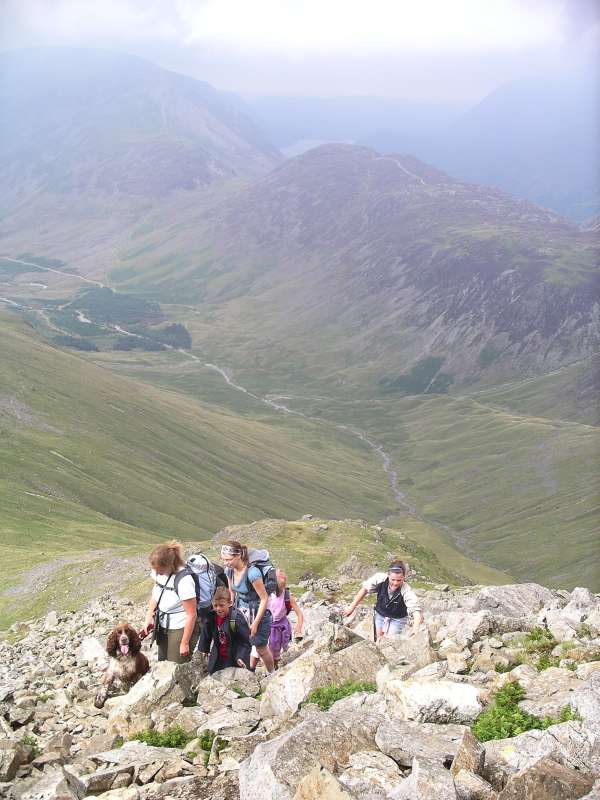
Great Gable from Wasdale Head, Copyright Mary Welsh, © 2007 Cross the footbridge over Gable Beck and take the left turn, a long, slanting, generally grassy path, through bracken, striking upwards and known as Gavel Neese (Gable’s nose). This leads, first, to a gate and, beyond, the path continues with some pitching as it ascends the steeper way. Then you reach the start of the very rough continuing path as it turns slightly left and runs below the west face of the mountain, which here is one great mass of very steep scree. Pause to look, left, to the great trench of Ill Gill and then turn round to enjoy the valley far below. The surface of the path has been reinforced with large stones, which have a tendency to roll. Take care as you ascend the steeply climbing way, which eventually leads you to Beck Head. Keep to the right of a spur between Kirk Fell and Great Gable and, when you spot the old fence posts, look for one of the many paths that climb right. These paths very soon join to become one. The steep route to the summit keeps to the right of the precipitous Gable Crag. The narrow, stony way is cairned and zig-zags round huge boulders and outcrops. Look up, as you go, to see each cairn. And then you reach the stony summit at 899 m (2949 feet). Walk ahead to the bronze memorial tablet fixed to the north face of the topmost crags of Gables’s crown. It is dedicated to those who died in the 1914-18 war. Spend time enjoying the view. Look for the Scafells and for Ennerdale, Crummock Water, Haystacks and more.
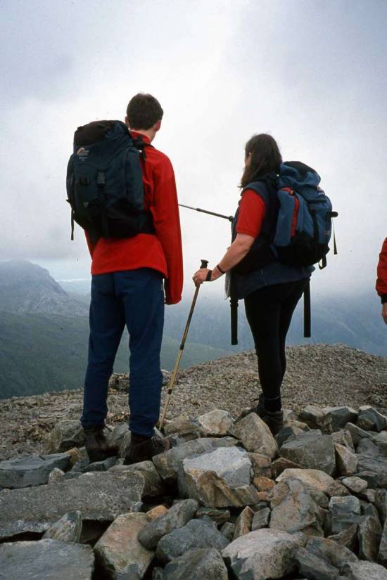
Leave, east of south, to pick up the Breast route. This is cairned and pitched for its entire length. It goes down and down, gently winding back and forth. The steps are shallow and the path is drained. Many of the rocks used are pink Ennerdale granophyre. Not one step moves beneath your feet as you go down and the pitchers deserve many congratulations on their skill. From this easier route off Great Gable, enjoy the view down to Sprinkling Tarn and then Styhead Tarn. The pitching ends at Styhead, by the stretcher box, where you turn right to join the path that descends steadily for a mile to return you to Wasdale Head. As you go, pause to look across the valley, left, to see the great cleft of Piers Gill and forward for a pleasing view of Wasdale. You do eventually reach the footbridge over Gable Beck and from here you need to retrace your steps to the car park. Pause once more to look back to most people’s favourite fell. Its shape is of a real mountain, one drawn during childhood, shaped, from this viewpoint, like a pyramid. Copyright Mary Welsh, © 2007. All rights reserved. No reproduction without permission. 2 Scafell PikeScafell Pike Factfile NB: Choose a good day for this expedition. Start early. Carry appropriate clothing, equipment and wear suitable footwear. Take spare food and water. Tell someone where you are going and let them know when you have returned. Avoid Scafell Pike in the mist. Most walkers in the Lake District eventually want to tackle the highest fell in England - Scafell Pike 978 m (3,210 feet). To me it is the hardest fell to climb, not because of its height but because of the unrelenting boulders and rock for most of the way, both up and down, on this circular route. The summit is a vast domed sea of boulders over which walkers need to step carefully. Even lichen, moss and club moss find it too inhospitable to flourish. And yet once you are standing on the top of the huge cairn, with its plaque to the war dead, the sense of achievement you experience by reaching this highest of all English summits is a tremendous reward for the great effort. From Brackenclose car park, continue along the reinforced track to cross the cattle grid. Go on, keeping left of the climbing hut and to the right of Lingmell Gill. Ahead stands the bulk of the Pike, with the summit just out of view. Go over the glorious tumbling beck by the footbridge, its white-topped flow a perfect foil for the dark green holly, paler ash and masses of ferns and foxgloves. Continue on up, with the beck to your right, to a well arrowed kissing gate onto the bracken-clad slopes of Brown Tongue. Go through the next gate and look back to see Wastwater, the Irish Sea and Galloway. Go on up the pitched path, which brings you to the side of the beck by a pretty waterfall, where you have to scramble across and which might cause problems if the stream is in spate. Then it’s up and up, with progress easy on the path. You are now under the shadow of Scafell’s formidable Black Crag. At the branching of the path, and the end of the pitching, take the left fork for Hollow Stones. The way continues, indistinct but well cairned, into a large bowl-shaped depression, with jagged outcrops and an enormous number of huge boulders. Some would say it is a lonely desolate place and yet it was here on August 5, 1802 that Samuel Taylor Coleridge, using a ‘nice Stone Table’ wrote in his notebook, ‘here I could lie warm, and wait methinks for tomorrow’s Sun’. Little constructions of rock seem to suggest that other folk have used this hollow for a shelter. Let the cairns lead you up the far side of the basin and then go on to climb steadily. To your left is Lingmell. Follow the ‘path’ to Lingmell col, from where you can glimpse Styhead Tarn and Derwentwater. Here swing right and climb the rough rocky way, still cairned way (no real path) and bearing right. It then starts to climb over several large tiers of rock to reach to a huge cairn - but not the summit one. From here proceed across the vast cairned area of boulders to the summit cairn, visible at last and stake out a space to eat your lunch. Wander around this tumbled wilderness of stone and name all the fells you can see. Read the plaque on the side of the cairn and then set off north-east, towards the spiky top of Broad Crag, carefully descending to its col. The view into Little Narrowcove from the here is a green delight but not on the route of this walk.
Begin to climb again, following the cairns, over a stretch of huge boulders and with the path up Great End to be seen directly ahead across Calf Cove. Then descend the rough way to the cove. Summit of Scafell Pike Copyright Mary Welsh, © 2007 Wind right to walk an easier way with wonderful views of Esk Pike and the Crinkle Crags. Look right to see the Coniston Fells and, to the left of Esk Pike, the Langdale Pikes. At Esk Hause, where the ground opens out before continuing on to Allen Crags and Glaramara, turn left down a stony, cairned track that descends steeply below the imposing prow of Great End. Eventually it arrives at the side of magnificent Ruddy Gill. Pause here, in high summer, to enjoy the roseroot flowering on ledges and in crevices for the pretty mossy saxifrage. Continue on down past Sprinkling Tarn and then descend the
pitched way to Sty Head. Here the marsh across to the stretcher box has
been stepped with huge boulders. Wind steadily left to begin your
descent of the path to Wasdale Head. Cross Gable Beck by its long
footbridge and carry on through Burnthwaite farm. Continue on the walled
lane and watch out for the sign directing you right towards to Wasdale
Head. Or carry on to visit the smallest church in England. Most walkers
will want to linger awhile at the inn. Then, whichever way you choose,
carry on down the valley road to rejoin your vehicle at Brackenclose.
|
|