|
|
Lake District Mountain and Fell Walks 4
7 Stone Arthur or Arthur’s ChairStone Arthur Factfile From the car park, turn right to walk to the A591. Cross, and continue ahead, keeping to the right side of the Swan Hotel. Carry on uphill, ignore the right turn and, a few steps along, take a tarmac track, on the right, which appears more like the entrance to a house than the way onto the fells. As you ascend, enjoy the dancing beck, on your right, that flows out of Greenhead Gill. Go through the farm gate and turn sharp right to cross the stream by a footbridge. Walk left and begin your steepish ascent along a good path that keeps close to the plantation wall on your right. The way is good underfoot: it is partly stepped, partly pitched, often grassy, sometimes naturally rock-stepped, and it has some foot holes in the turf. Wind round, right, with the wall at the end of the conifers, and follow
the distinct way. Eventually the wall turns away right again and, this
time, the path goes on up towards prominent Butter Crag. Here it winds
on, right, below the crag, passes a boggy area and brings you to a gate
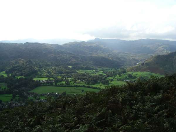
in the wall. Beyond, on a grassy shelf, above Grasmere, lies charming Alcock Tarn.
Continue along the
right side (west) of the tarn; if the sun is shining look for the
hundreds of small fish idling in the warm shallows. Wind round left,
walking along the tarn’s small dam, and go through a railed gap in the
wall ahead. Beyond, stroll the grassy path that climbs steadily through
the bracken. Follow it as it winds right, still gently ascending,
eventually to join the Fairfield Horseshoe path, coming in on your
right, from Rydal. Stroll on to pass, close on your right, more outcrops, where you might wish to stop and take your first break. Then go on along the easy path, mainly grassy, towards Great Rigg, which, unlike Heron Pike, does have a fine peak. As you progress, the view of Fairfield’s wall-like southern face is formidable, its summit overtopping all other heights. A short way up the slopes of Great Rigg, you arrive at a cairn. Here turn sharp left and follow a delightful grassy trod, along the almost level top of a spur of Great Rigg, heading towards the first outcrops of Stone Arthur. This is a glorious stretch of path, with stunning views.
Stroll on, passing through a series of large rock outcrops until, finally, you can stand on the abrupt edge of the steep drop of the last one. Pause near the edge to enjoy the superb view of Sourmilk Gill waterfall tumbling out of Easedale Tarn, surrounded by a multitude of heights. Turn round and, if you use a little imagination, the low walls of rock, on three sides of a grassy area, seem like a giant armchair: Arthur’s Chair at 501 m (1,652 feet). Return along the path for a short distance until you reach a cairned path going off right (it was on your left when you continued to the edge of the last crag). Follow it as it keeps below the crags and also, as it descends a wide grassy path between bracken, soon comes close to a derelict wall on your right. Head on down, with more of Grasmere and its lake revealed below. At a widening of the path, where derelict walls meet and are almost obscured by bracken, turn right to descend a narrow, rougher way to a solitary sycamore, some way down the path. Beyond, carry on traversing the slopes, to step across a stream. Follow the path as it steadily winds left and descends again, to come to the side of a walled conifer plantation, on your right. Continue down until you have to wind left and the path becomes a wide rough track. It goes on descending and comes to the farm gate taken earlier. Turn right through it and descend to Grasmere. Copyright Mary Welsh, © 2007. All rights reserved. No reproduction without permission. 8 St Sunday CragSt Sunday Crag Factfile
View from Summit (Copyright Mary Welsh, © 2007) Leave the car park by a gap stile in the wall. Cross the road and walk left to pass some shops. Wind round right, as directed by a signpost, to pass the toilets on your left. Climb the track and follow it as it bears right to come to a cross of tracks. Turn left and stroll a path through verdant vegetation and, at a wider track, go left to pass through a kissing gate. Walk the wide track for a short way and, at a wall corner, on your right, look for unmarked steps over the wall hidden by a tree. Beyond, where there is a signpost, bear left and walk on the indistinct but clearly arrowed park-like way. This leads to a kissing gate onto a track, where you turn right to walk on to join the metalled road that leads from the village into Grisedale. Turn left and begin a steady climb along the leafy way. Peep over the wall to see Grisedale Beck far down in its gill. Carry on the metalled way, overlooked on your left, first by Thornhow End and then by Birks. Carry on, ignoring all footpaths and roads turning off on your right. Keep ahead along the continuing track to pass Elmhow farmhouse and then walk left of its barn, with a fine view of St Sunday Crag ahead. Once past oak woodland, on the right, stride out into the lonely valley, with the high fells closing in on either side. Ignore the path going off right and down to a bridge over the Grisedale Beck and head on the now rougher, rising way. Follow the track as it descends to cross a footbridge, where a rowan thrives on the banking of the stream, and go on a rather soggy way to cross another footbridge over the beck rushing out of Ruthwaite Cove. Then wind left and climb up, to pass Ruthwaite Lodge, used by an Outward Bound group. Walk on the much more challenging way and go on up and up until, at Tarn Crag, you have a sudden, exciting view of Grisedale Tarn, serene in its mountain hollow. Descend to the water’s edge and cross the outlet stream on small stepping stones. Two steps on, turn left and begin your ascent of a pleasing path, boggy at first and then improving greatly. From here you can see the sign for the Bothers’ Parting Stone, where William Wordsworth said goodbye to his brother John, who was later lost at sea. At a junction that is not very clear, climb right and follow the path, which soon becomes distinct and bears left, rising gently. If you have missed this turn a path goes ahead until it turns right up through a rocky gill. The higher path joins the gill half-way up. Then it is a short scramble on to Deepdale Hause. Turn left and climb the distinct, stony, but generally easy path, for half a mile to the plateau-like summit, with its two cairns - the route never in doubt. The top is reached over several brows, each of which seems to be the top - for there to be another ahead! Enjoy the immense view from the first summit cairn, from where you can see ridge after ridge stretching, east, away into the distance. Then walk to the northern-most cairn for a superb view of Ullswater, Glenridding, and the misty Pennines. To the west you can spot Striding Edge. Continue on, north-east, strolling the cairned way to descend to a wide track that then leads up to Birks. It is a fine little peak, with superb views of Ullswater, but ascended by a rough path. Pause once more to see the walkers toiling up the path to the ‘hole-in-the-wall’ on their way to Striding Edge and an even more spectacular view of Ullswater before descending to carry on along the stony path. Ignore the temptation to climb the grassy way to Glenamara Park - save that for another day - and remain on the main rocky path to walk ahead, with steep dramatic Black Crag to your right, to go through a gate in the wall. Descend the reinforced track that winds down through the bracken-clad slopes and scattered trees of Thornhow End to reach a stile over a fence. Beyond, turn left. Descend to pass through a gate to the lane. Turn right and, soon, right again to retrace your outward route to the parking area. Copyright
Mary Welsh, © 2007. All rights reserved. No reproduction without
permission. |
|